Map of the Battle of Lexington and Concord
|
|
This Site:
|
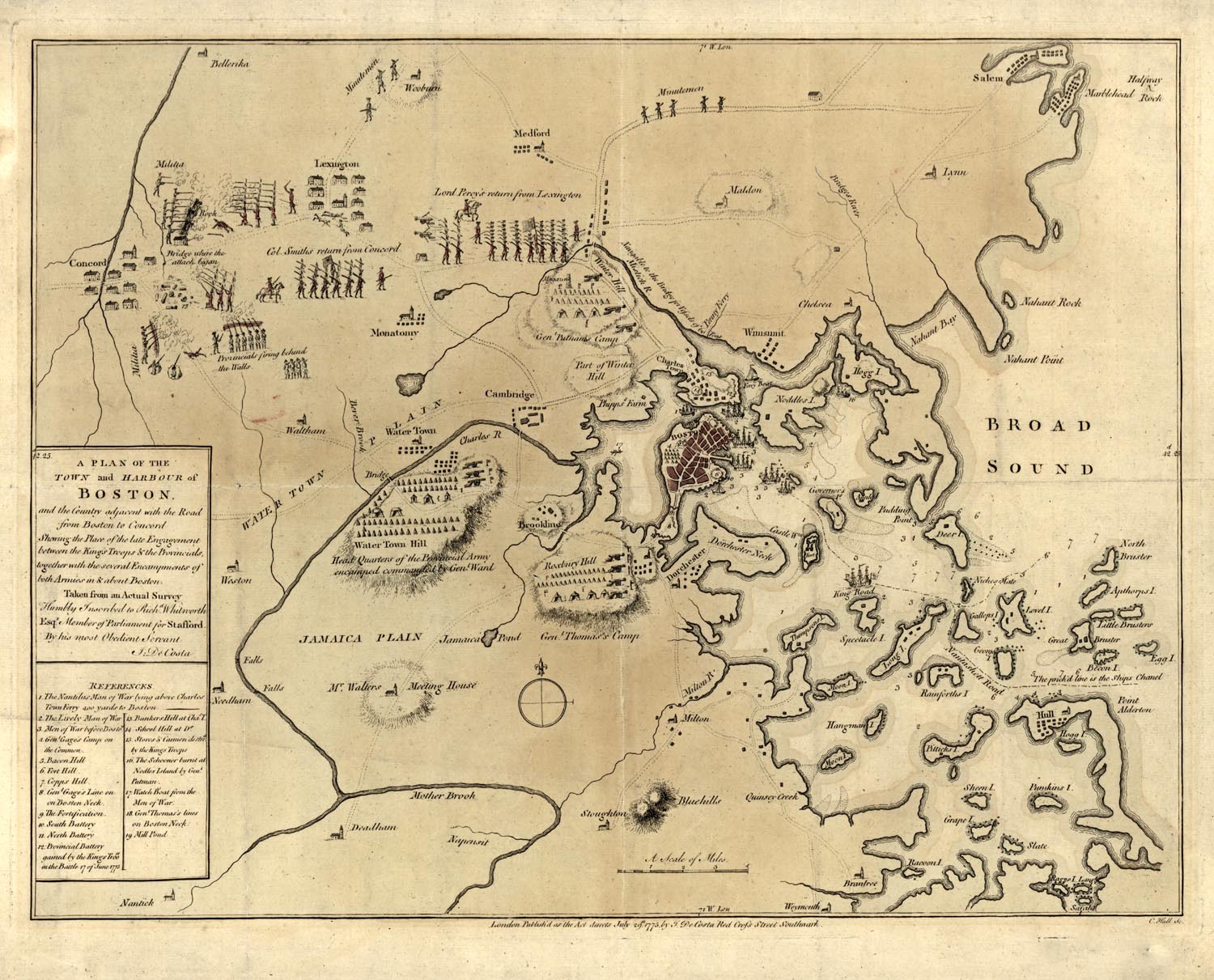
Above we present an original 1775 Map showing the Revolutionary War Battle of Lexington and Concord. It was printed on July 29, 1775, within days of the actual battle. The legend on the left of the map reads, "A Plan of the Town and Harbor of Boston. and the Country adjacent to the road from Boston to Concord, showing the place of the late engagement between the King's troops and the Provincials, together with the several Encampments of both armies in and around Boston." This is an incredible resource as it was created at the time of he battle, and shows many important details of this most important event in World History. The map shows the position of Patriot Militia and Minutemen south of Concord, and the location of the King's troops which they faced. It is interesting that this map explicitly pictures the Minutemen fighting from behind rocks, walls, and other protective structures, while the British redcoats are pictured fighting out in the open. I think that shooting from cover was a novel concept at this time, and likely viewed as somewhat cowardly by professional soldiers of the day. The map picture's Colonel Smith's troops returning to Boston from Concord, and the retreat of Lord Percy from Lexington. |
|
|
||
|
|
Site Copyright 2003-2018 Son of the South. For Questions or comments about this collection, contact: paul@sonofthesouth.net |
|
|
Are you Scared and Confused? Read My Snake Story, a story of hope and encouragement, to help you face your fears. |
||