|
This Site:
Discovery of America
The Explorers
Post Columbian Exploration
Thirteen Original Colonies
Colonization of America
Colonial Life
Colonial Days and Ways
Independence Movement
The Patriots
Prelude to War
Revolutionary War
Revolutionary War Battles
Overview of Revolutionary War
Revolutionary War
Timeline
Civil War
American Flag
Mexican War
Republic of Texas
Indians
|
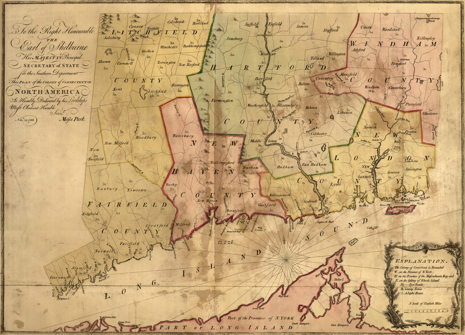
Map of Colonial Connecticut
This is an original map created in 1766 which
shows the Colony of Connecticut, one of the original 13 American
Colonies. The map shows the terrain, rivers, towns and villages in the
area in colonial times. The map is titled, "To the right honourable,
the Earl of Shelbourne, His Majesty's principal Secretary of State
for the Southern Department. This plan of the colony of
Connecticut in
North-America. Is humbly dedicated by his lordships most obedient
humble servt. Moses Park. Novr. 24, 1766."
|