Map of the Massachusetts Colony
|
|
This Site:
|
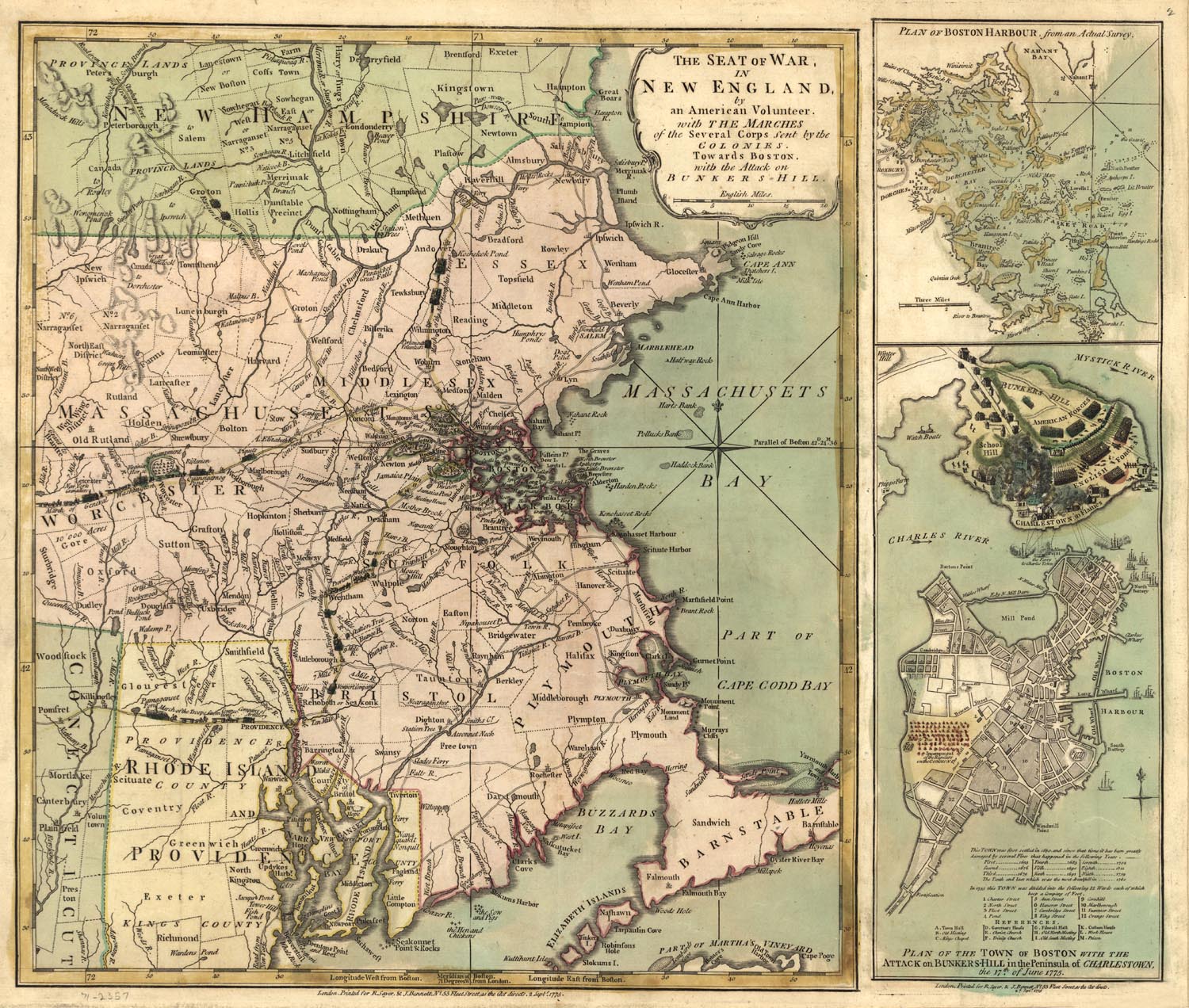
Above we present an original 1775 Map showing the Colony of Massachusetts. The map is titled, "The Seat of war in New England, by an American volunteer, with the marches of the several corps sent by the Colonies towards Boston, with the attack on Bunkers-Hill." The map also shows inset enlargements of the town of Boston, and the town of Charlestown, as they looked during the Revolutionary War. These insets are captioned, "Plan of Boston Harbour, from an actual survey" and "Plan of the town of Boston with the attack on Bunkers-Hill in the peninsula of Charlestown, the 17th of June, 1775." This map includes details of cities and towns, terrain, rivers, streams and harbors. It provides incredible details on this region during this critical time in American History. |
|
|
||
|
|
Site Copyright 2003-2018 Son of the South. For Questions or comments about this collection, contact: paul@sonofthesouth.net |
|
|
Are you Scared and Confused? Read My Snake Story, a story of hope and encouragement, to help you face your fears. |
||