|
This Site:
Discovery of America
The Explorers
Post Columbian Exploration
Thirteen Original Colonies
Colonization of America
Colonial Life
Colonial Days and Ways
Independence Movement
The Patriots
Prelude to War
Revolutionary War
Revolutionary War Battles
Overview of Revolutionary War
Revolutionary War
Timeline
Civil War
American Flag
Mexican War
Republic of Texas
Indians
|
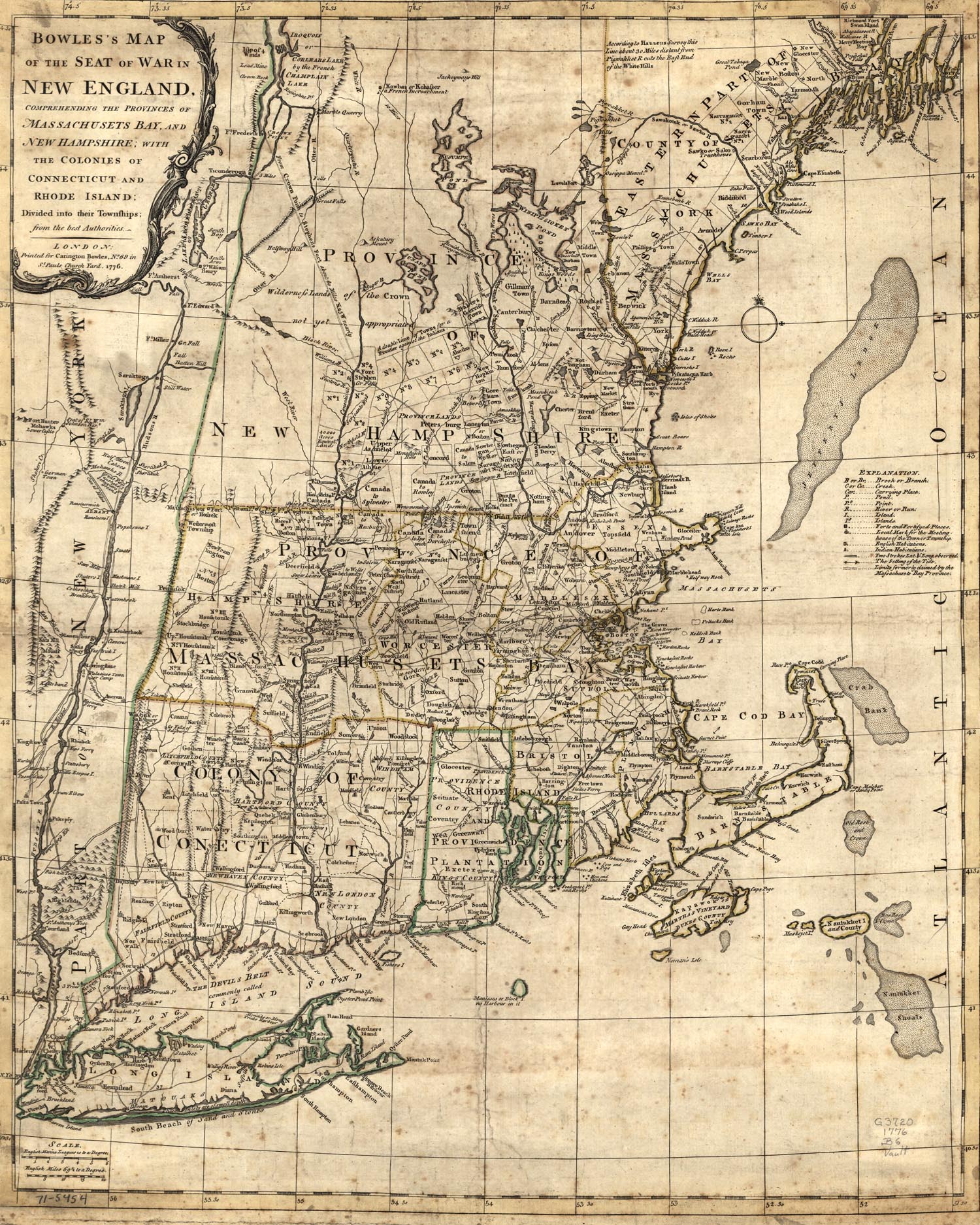
Map of Colonial New England
This is an original map created in 1776 which
shows New England in Colonial times. The map is labeled, "Bowles's
map of the seat of war in New England. Comprehending the provinces
of Massachusetts Bay, and
New Hampshire; with the colonies of
Connecticut and
Rhode Island; divided into their townships; from the
best authorities." The map was created in London. It has incredible
detail on the terrain, rivers and streams, and towns at the time of
the Declaration of Independence, and the Revolutionary War.
|