New Jersey Map
|
|
This Site:
|
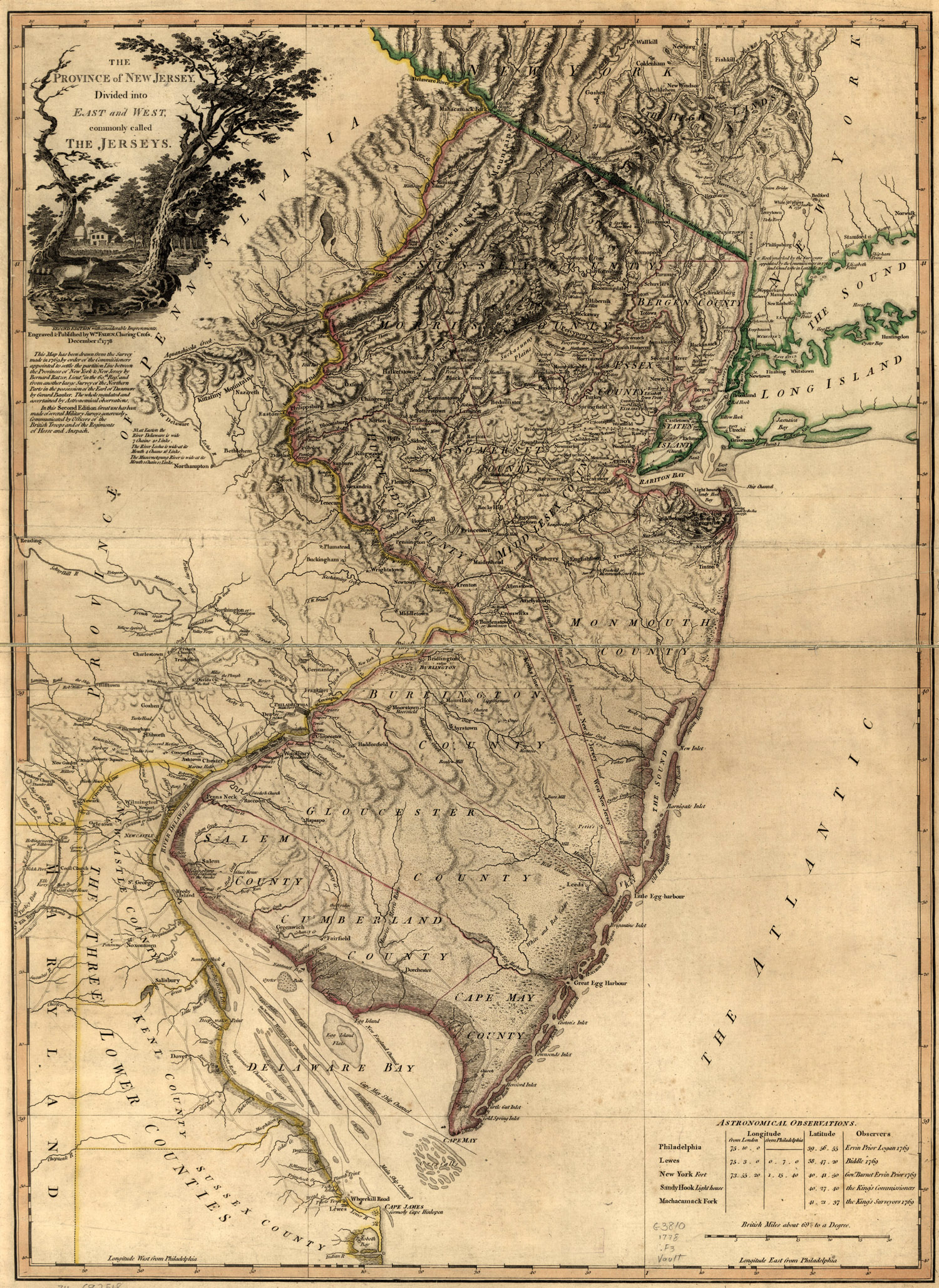
This is an original map of the New Jersey colony created in 1769.
The map shows incredible details of the region, including towns,
waterways, terrain, and boundaries. The map is titled, "The Province
of New Jersey, divided into East and West, commonly called the
Jerseys. Engraved & published by Wm. Faden." Shows county boundaries
and "Division line run in 1743 between East New Jersey and West New
Jersey." Includes a table of "Astronomical observations." The
map was drawn from a survey made in 1769. |
|
|
||
|
|
Site Copyright 2003-2018 Son of the South. For Questions or comments about this collection, contact: paul@sonofthesouth.net |
|
|
Are you Scared and Confused? Read My Snake Story, a story of hope and encouragement, to help you face your fears. |
||