|
This Site:
Discovery of America
The Explorers
Post Columbian Exploration
Thirteen Original Colonies
Colonization of America
Colonial Life
Colonial Days and Ways
Independence Movement
The Patriots
Prelude to War
Revolutionary War
Revolutionary War Battles
Overview of Revolutionary War
Revolutionary War
Timeline
Civil War
American Flag
Mexican War
Republic of Texas
Indians
|
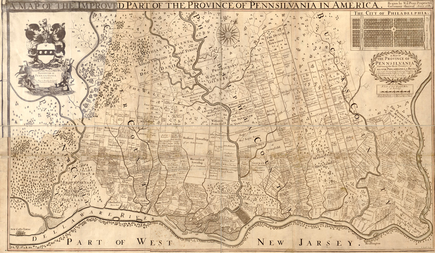
Map of Pennsylvania
During the Colonial Days (1705)
This is an original map created in 1705 which
shows parts of Pennsylvania. The map is titled, "A map of the
improved part of the Province of Pennsilvania in America : begun by
Wil. Penn, Proprietary & Governour thereof anno 1681 / by Tho.
Holme, Survey'r Gen'l ; F. Lamb sculp." and has caption, "Map
of the Province of Pennsilvania containing the three countyes of
Chester, Philadelphia & Bucks : as far as yet surveyed and laid out,
ye divisions or distinctions made by ye different coullers, respects
the settlements by way of townships ". Statement of dedication at
upper left: To the worthey William Penn Esq., Proprietor of
Pennsilvania in America, this map is humbly dedicated by Iohn
Thornton & Robert Greene. Shows rural landholders' names, lot lines,
and proprietary manors. Includes inset of "The city of Philadelphia"
and Penn coat-of-arms.
|