Mason Dixon Line


This Site:    

Slavery Home

Slavery History

Slave Photographs

Slavery Pictures

Slave Maps

Slave Ships

Slave Trader

Abraham Lincoln

Civil War

Civil War Overview

Harper's Weekly

Links

Search this Site


Civil War Art

Revolutionary War

Mexican War

Republic of Texas

Westward Expansion

Winslow Homer

Thomas Nast

Mathew Brady

Western Art

Civil War Gifts

UpGeorgia Slave MapSouth Carolina Slave MapUnited States Slave MapColton's 1861 Slave Map of Southern StatesMason Dixon LineMap of Free and Slave StatesVirginia Slave MapSlave Census

Mason Dixon Line

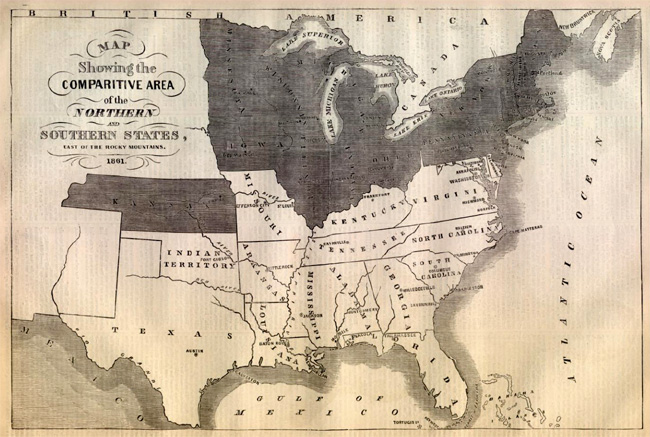
This is an original and incredible 1861 map showing the Mason Dixon Line.  Northern States are shaded dark, and Southern States are light.

The inset text on the map reads:

MAP

SHOWING THE

COMPARATIVE AREA

OF THE

NORTHERN

AND

SOUTHERN STATES,

EAST OF THE ROCKY MOUNTAINS

1861


 Email us at: paul@sonofthesouth.net

Copyright © 2003-2018 Son of the South.


Privacy Policy


Are you Scared and Confused? Click Here to read My Snake Story, a story of hope and encouragement, to help you face your fears.